1830 BLM Survey Map
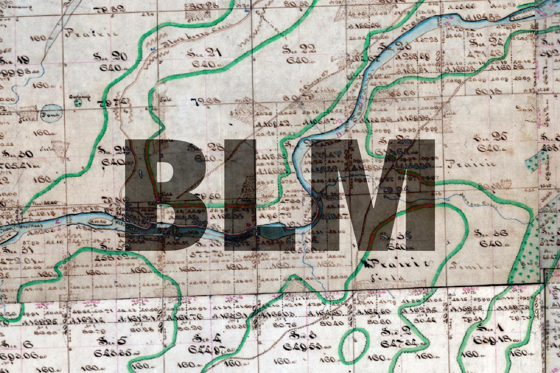
This basemap represents one of the oldest “official” maps of Kendall County. When the Federal government first surveyed the County in the 1830s, surveyors kept meticulous records of the landscape. These records were later used in 1859 to create a cartographic representation of the locations surveyed.
Though the county was already settled in many places at the time of the survey work (Yorkville and Oswego are already established), the map gives a picture of what an early, less-developed Kendall County might have looked like, with much of the original forest and prairie areas still intact.
The basemap is made available as XYZ Tiles. In many GIS softwares and websites, these tiles can be accessed by using a template URL.
The template URL for this basemap is:
https://tiles.kendallcountyil.gov/1871/{z}/{x}/{y}.jpg