1922 Plat Atlas
This basemap comes from a Plat Atlas book from 1922, georeferenced and stitched together by Kendall County.
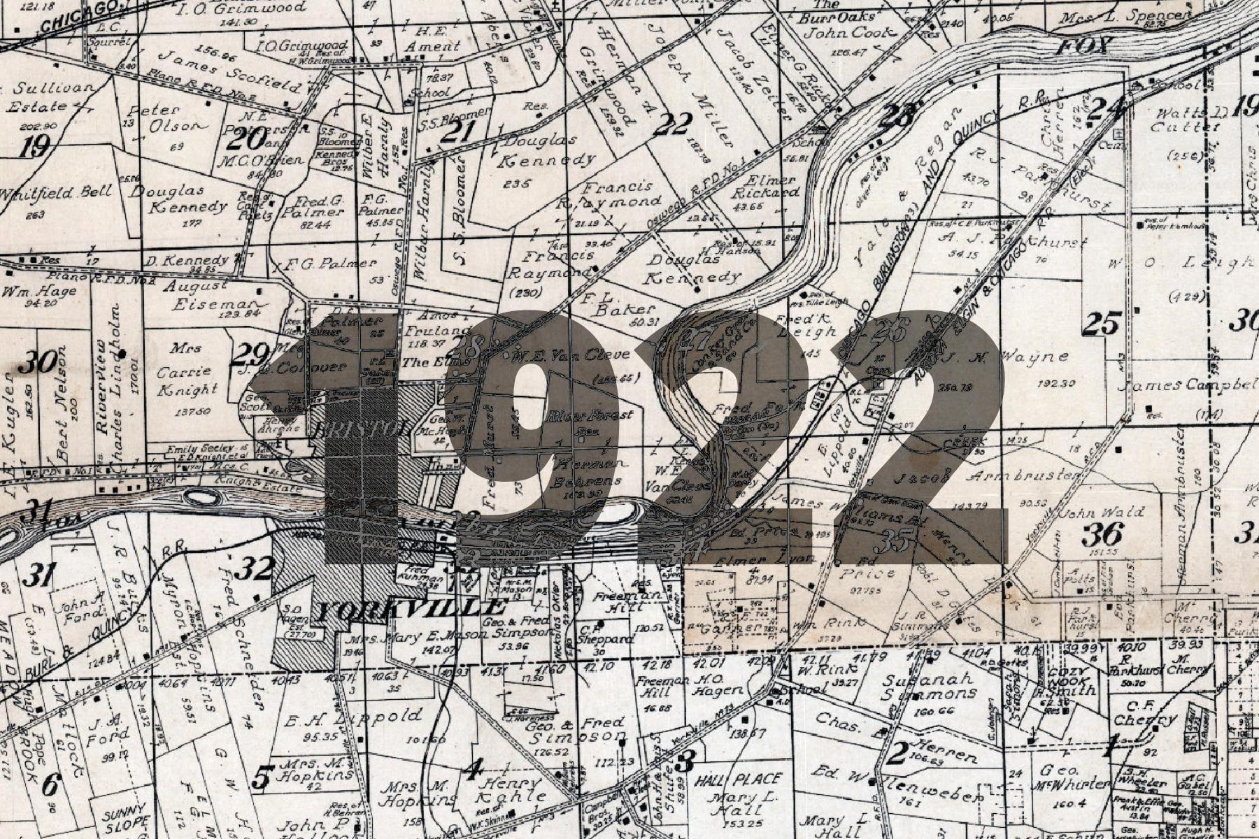
Less colorful than earlier plat books, this map stands out for including the names of prominent residences and farms, such as “Burr Oak Farm” and “The Maples”. The map also includes extensive infromation about roads and rail lines.
The basemap is made available as XYZ Tiles. In many GIS softwares and websites, these tiles can be accessed by using a template URL.
The template URL for this basemap is:
https://tiles.kendallcountyil.gov/1922/{z}/{x}/{y}.jpg